|
||
|
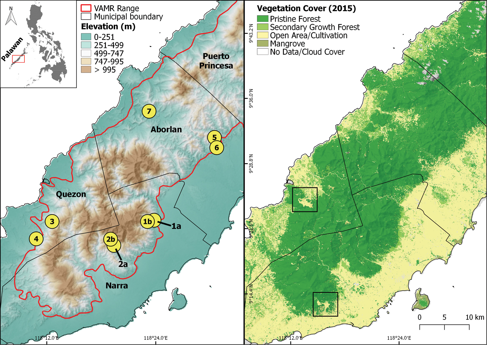
Map of Victoria-Anepahan Mountain Range (VAMR), of central Palawan Island, Philippines (inset map). The right panel includes sampling sites, indicated by numbered circles. The extent of the VAMR is indicated (red polygon) and the elevation represented by incremental coloured shading. The left panel shows the vegetation cover of VAMR based on 2015 Land Satellite Image, reproduced from Supsup and Asis (2018). Boxes indicate locations of two mining areas in close proximity to the VAMR massif. |